Contributor: Elephango Editors. Lesson ID: 10477
Travel the globe without leaving your seat as you explore how geography helps us know where we are—anytime, anywhere!

"Are We There Yet?"
Imagine trying to meet up with a friend in a giant city—without phones, maps, or GPS. No pin drops. No directions. Just vibes.
Now imagine doing that on a planet that's over 24,000 miles around.
Luckily, the earth comes with its own invisible grid—kind of like a giant game board. And this grid helps you find any place, anywhere, anytime.

Whether you're trying to find a rainforest in Brazil, a pizza shop in Chicago, or your favorite hiking trail, the secret is knowing how to talk the language of location.
Welcome to the first theme of geography, where you'll discover how absolute and relative locations help humans organize the world, navigate it, and even plan when to catch a sunrise.
How to Find Yourself on the Earth
What is location, really?
In geography, location means more than "somewhere over there." It's about exactly where something is—or where it is in relation to something else.
Geographers divide location into two types.
Absolute location is a precise point on the globe, using a global address called latitude and longitude.
Relative location is a more casual description that tells where something is by comparing it to other things. Like, "My school is across from the park," or "We live three blocks west of the post office."
Let's break those down.
Latitude and Longitude: Your Global Coordinates
Think of the earth like a giant ball wrapped in two kinds of invisible hoops.
Latitude lines go around the earth horizontally, like stacking hula hoops from the equator up to the poles. These lines measure how far north or south a place is from the equator (which is 0° latitude).
Longitude lines stretch up and down from the North Pole to the South Pole. These are called meridians, and they measure how far east or west a place is from the Prime Meridian, which is 0° longitude and passes through Greenwich, England?.

Geographers can pinpoint any location on the planet using degrees, minutes, and seconds.
For example, the coordinates for the Coronado Bridge in San Diego are 32°42'54 "N, 117°09'25 "W.
That's your absolute location.
Time Zones: Why It's Tomorrow in Some Places and Yesterday in Others
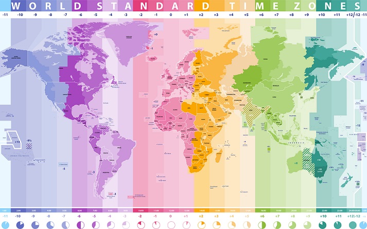
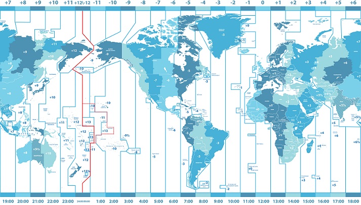
Maybe it was 10 AM for you, but midnight for them. That's because the earth is divided into 24 time zones, each one based on a 15° slice of longitude.

These time zones start at the Prime Meridian. As you move east, the time gets later. Move west, and you go back in time—kind of like a time-traveling geographer.
Some time zones are strange, like Nepal's, which is set to UTC +5:45. And don't even get started on Australia, which has both half-hour and quarter-hour zones!
The International Date Line. This zigzagging line near 180° longitude decides where one day ends and the next begins.

Cross it from west to east, and you'll jump back a day. Cross it the other way, and you skip ahead.
Reading Maps Like a Pro
Maps are more than pictures. They're powerful tools that help you read the landscape. Every map has the following.
Cardinal directions: North, South, East, and West
Scale: Shows distance, like one inch = five miles.
Legend: Explains what the map symbols mean.
Symbols and colors: Blue for water, green for forests, and so on?.

You can even use topographic maps to spot mountains, valleys, or hiking trails based on contour lines that show elevation.
Maps + latitude and longitude = You're basically a navigation ninja.
Ready to Practice?
You now know how location helps us organize and understand our world—from cities to coastlines, farms to front porches.
Next, see how well you've got it down. In the Got It? section, you'll review key ideas, test your knowledge, and even have a little fun navigating imaginary adventures.
Put your map skills to the test!.